Historian Eric Gonzaba’s college students aren’t familiar with the concept of a physical guide book. Their world is a digital one, where cell phones contain infinite travel guides. With a few taps, they can find food, bars, places to crash. There’s no need for excess paper or a winding map—no need, even, to know their way home. But Gonzaba, who researches historical gay nightlife, sees the connections between the ease of the present and the nitty-gritty logistics of the past. When he conducted oral history interviews on 1970s to 1990s nightlife, his subjects didn’t mention Yelp, Google Maps, or Airbnb. Often, their experience navigating queer spaces existed between the covers of a pocket-sized travel guide, known as Bob Damron’s Address Book.
In 1964, California businessman Bob Damron was filling a void. A frequent traveler himself, he began publishing his guides annually as a way to help queer individuals, particularly gay men, navigate both their hometowns and unfamiliar spaces (similar to the earlier Negro Motorist Green Book, which aided Black travelers). Damron’s guides, colorful and discreet, listed known queer haunts across the U.S., as well as their defining features.
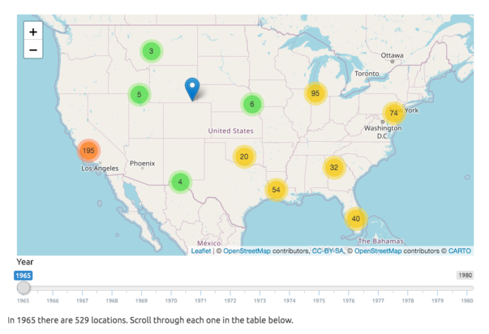
Now, Gonzaba and co-primary investigator Amanda Regan are using Damron’s 1965-1980 books to map historical queer spaces, moving state by state in an effort to understand the trajectory of queer communities and place them in context. Their archival project, titled “Mapping the Gay Guides,” is a collection of digital maps, each covering a year of Damron’s guides. On the project’s website, listings are transformed into blue pins—users can watch locations, including a stray Waffle House in Fort Meyers, Florida, appear and disappear, reflective of a shifting queer landscape. Click on a pin, and the listing’s name and “establishment features” emerge. Click away, and pins coagulate, then split, then scatter again; the map begins to resemble an unwieldy constellation, constantly in flux.
Since February, Mapping the Gay Guides has placed pins on 23,000 listings in 32 states and D.C., hoping to complete the rest by fall. While the project will be a comprehensive resource—Gonzaba and Regan hope to eventually map past 1980—it also aims to stretch the margins of Damron’s guides, which relay history from the perspective of a coastal white man. Gonzaba, Regan, and their team are especially interested in geographies outside of the well-trod coasts, and in exploring even incomplete data. “I’m from a small town in Indiana, and it’s fascinating to think that people look at places like Indiana and say, ‘Do they have a queer history?’” Gonzaba says. “Well, according to these guides, they do.”
A screenshot from the Mapping the Gay Guides project
Courtesy Mapping the Gay Guides


